Lake Nakuru National Park

Kenya Top Destinations

Lake Nakuru National Park

Lake Nakuru National Park is famous for its diverse avian population, boasting more than 400 bird species, including vast gatherings of flamingoes and various other aquatic birds. This park offers exceptional opportunities for wildlife observation and is a habitat for numerous water-dependent creatures like hippos and waterbucks. Exploring Lake Nakuru National Park on a safari can be accomplished within a single day or can be combined with a visit to Lake Naivasha and the neighboring Aberdare National Park, enhancing the overall experience.

Lake Nakuru National Park was established in 1961 and is currently spread across an area of 180km² (69.5 square miles). Situated in the Great Rift Valley, it is located 156km northwest of Nairobi in the Nakuru district of the Rift Valley Province. The park is under the management of the Kenya Wildlife Service.

Surrounded by marshes, woodland, and grassland, Lake Nakuru is a sizable and shallow lake. On its eastern side, you can find rocky outcrops and the largest euphorbia forest in Africa. The lake is nourished by three main rivers, namely the Njoro, the Makalia, and the Enderitrivers, along with several springs. The park boasts well-maintained roads and offers stunning viewpoints like Baboon Cliff and Lion Hill, which provide breathtaking vistas of the lake.

One of the remarkable features of Lake Nakuru is the presence of the blue-green Cyanophyte Spirulina Platensis, which serves as the primary food source for the vibrant pink flamingoes that can be observed wading along the lake’s edge. The number of flamingoes can reach up to two million, including both greater and lesser flamingoes, along with numerous other bird species. However, it is important to note that the bird population can vary due to changing food conditions. Therefore, it is advisable to check with the national park before embarking on a long journey to witness this spectacle. Carrying a spotter’s guide will also enhance your experience as you can identify the diverse range of animals and birds found in Kenya.

In addition to its avian inhabitants, Lake Nakuru National Park provides a safe haven for a multitude of native African animals. Visitors can encounter waterbucks, warthogs, impalas, buffalos, Rothschild giraffes, elands, endangered black rhinos, white rhinos, and occasionally, leopards. The northern part of the lake is home to a large herd of hippos, offering captivating game viewing opportunities.

By road:

The park is conveniently connected to Nairobi via a tarmac road, located 156 km northwest of the city on the main A104 road. The primary entrance to the park is through the main gate, which is only 4 km away from Nakuru Town Centre. Another option is to enter the park through Lanet Gate, which is situated along the main Nairobi Nakuru road. Additionally, the Nderit Gate serves as an entry point for those coming from Masai Mara or Elementaita.

By Air:

The Naishi airstrip caters to the needs of both tourism and KWS activities within the park.

The primary purpose of establishing the Lake Nakuru National Park was to safeguard the vast population of flamingos. Along the shores, waterbucks, Bohor-Reedbuck, and zebras can be seen leisurely grazing. Lake Nakuru serves as a habitat for both black and white rhinoceroses. Unfortunately, due to the detrimental impact of poaching, the number of black rhinoceroses had dwindled to just two by 1987. However, through the creation of a protected area for rhinoceroses within the park and implementing a breeding program in collaboration with Laikipia, the Kenya Wildlife Service (K.W.S.) successfully managed to increase the rhinoceros population. Observing wildlife in their natural habitat is relatively effortless and can be enjoyed until sunset. The forested areas of the park are home to various species such as buffalo, leopard, lion, Rothschild giraffe, and Colobus monkeys.

The climate surrounding the lake varies from cool to hot and humid. With an annual rainfall of 965mm, it is comparatively lower than several other regions in Kenya. The months of March to May and October to December experience the highest precipitation, although it is still not as heavy as in other areas.

You might also like

Amboseli National Park

Kenya Top Destinations

Amboseli National Park

Amboseli National Park, initially declared a national reserve in 1968, underwent a significant change in 1974 when it was officially designated as a national park. However, a controversial decision was made in 2005 by President Mwai Kibaki, transferring control of the park from the Kenya Wildlife Service to the Olkejuedo County Council and the Maasai tribe residing in the area. This decision has sparked ongoing legal disputes due to its potential implications for Kenya’s other national parks.

Covering an expansive area of 392km² (151miles²), Amboseli National Park boasts a diverse topography consisting of plains, acacia woodland, rocky thorn bush, swamps, and marshes. This varied landscape, combined with a lengthy dry season, provides an ideal environment for observing the abundant African wildlife that thrives within this natural habitat.

One of the park’s most remarkable features is its awe-inspiring view of Mount Kilimanjaro, Africa’s highest peak standing at an impressive 5,895m. This majestic backdrop adds an unparalleled beauty to the experience of observing Africa’s magnificent animals. Additionally, Amboseli National Park encompasses a dry Pleistocene lake basin that occasionally transforms into a temporary lake, known as Lake Amboseli, following periods of rainfall.

Due to the sparse vegetation caused by the extended dry months, Amboseli offers exceptional opportunities for spotting African wildlife. The park is home to a wide array of wild animals, including African elephants, buffalos, impalas, lions, cheetahs, hyenas, giraffes, zebras, wildebeests, and various other species. Bird enthusiasts will also be delighted by the abundance of birdlife in Amboseli, ranging from large to small species, provided they remain vigilant and observant during their visit.

Upon arrival at the park, visitors will receive a set of common-sense guidelines from the park warden. These rules include remaining inside the vehicle except at designated areas, refraining from disturbing the animals, sticking to designated tracks, avoiding off-road driving, and always yielding to the animals’ right of way. It is worth noting that the roads within Amboseli National Park consist of a loose volcanic soil surface, which becomes dusty during the dry season and impassable during the wet season.

By road:

The primary route to enter the park is through Nairobi via Namanga (240 km) on the Nairobi – Arusha Road, passing through Meshanani Gate. Another option is to take the road from Nairobi via Emali (228 km) on the Nairobi – Mombasa Road. If you are coming from Mombasa, the main access is through Tsavo West National Park via Kimana (Olkelunyiet) Gate.

By Air:

At Empusel gate, the park features a solitary airstrip designated for light aircraft. Additional airstrips can be found at Kilimanjaro Buffalo Lodge and Namanga town.

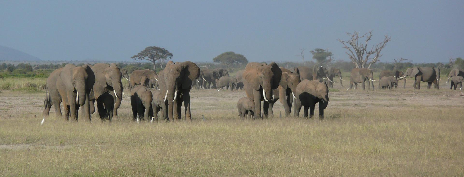
The primary objective of a wildlife safari is to observe Kenya’s wild animals in their natural habitat. It often surprises many individuals to witness birds perched within the striking distance of predators or gazelles grazing near large felines. However, the reality is that predators typically hunt for sustenance, and the rest of the time, both predators and prey coexist harmoniously. Amboseli National Park is renowned for its vast herd of more than 900 elephants that roam freely. It is the ideal national park to visit if you wish to witness these magnificent and colossal creatures. 

Additionally, you can enjoy a panoramic view or even ascend Mount Kilimanjaro, the tallest freestanding mountain globally. Don’t miss the opportunity to visit Observation Hill, which provides a vantage point overlooking the park, swamps, and, of course, the herds of elephants. Furthermore, you can immerse yourself in the Maasai culture and gain insights into their indigenous lifestyle by interacting with the Maasai people. For avid bird watchers, the period between October and January is the best time to spot Kenya’s migratory birds, such as African skimmers, red and yellow bishops, goshawks, buffalo weavers, and palm nut vultures, among others.

The Amboseli region experiences a hot and arid climate. Situated on the northwest side of Mount Kilimanjaro, the national park is in the rain shadow, resulting in minimal fluctuations in average temperatures throughout the year. The daily average temperature ranges from a minimum of 27°C to a maximum of 33°C. This area is prone to drought, with high rates of evaporation. The expected annual rainfall is only 300mm, occurring primarily in April, May, November and December.

You might also like

Mombasa

Kenya Top Destinations

Mombasa

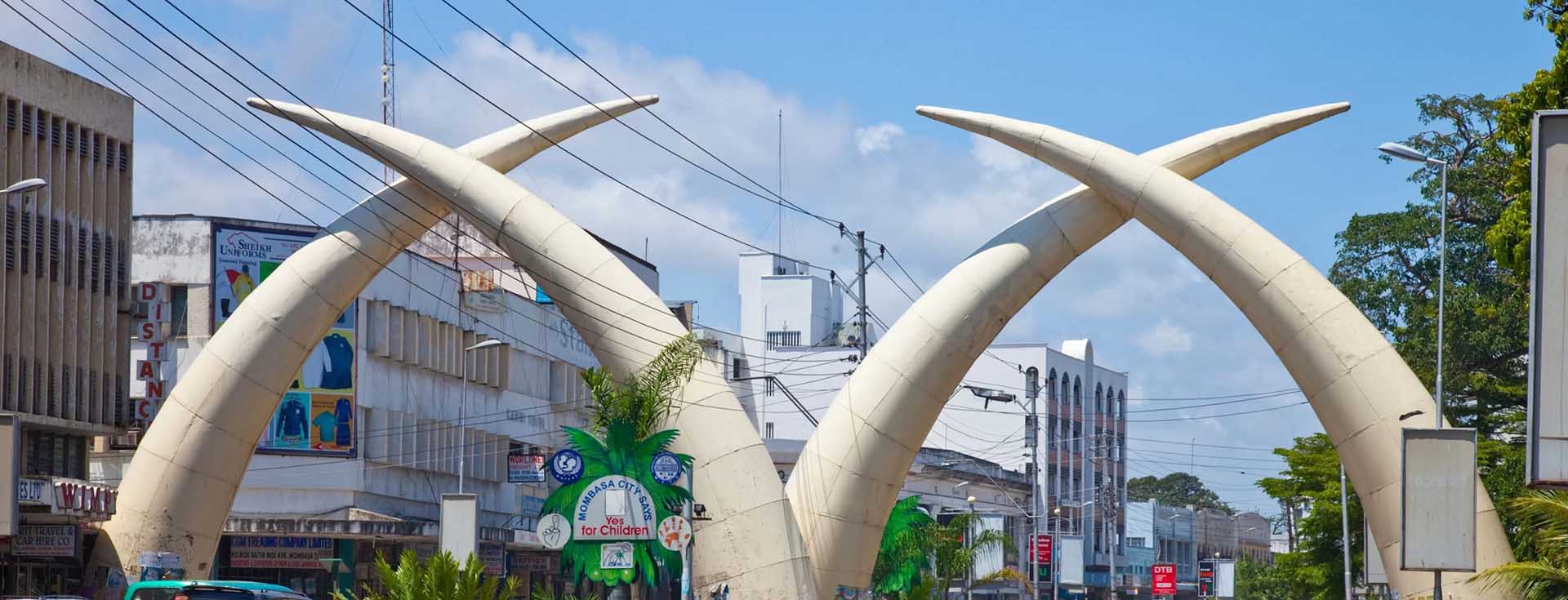
Mombasa (in Coast Province) is the second largest city in Kenya, lying on the Indian Ocean and is the host to the Coast Province administration. It has a major port and an international airport. The city is the centre of the coastal tourism industry. The original Arabic name is Manbasa; in Kiswahili it is called Kisiwa Cha Mvita (or Mvita for short), which means “Island of War”, due to the many changes in its ownership and the battles that brought about the changes in ownership. The town is also the headquarters of Mombasa District which, like most other districts in Kenya, is named after its chief town

The city is located on Mombasa Island, which is separated from the mainland by two creeks; Tudor Creek on the west and Kilindini Harbor on the south. The island is connected to the mainland to the north by the Nyali Bridge, to the south by the Likoni Ferry and to the west by the Makupa Causeway,  alongside which runs the Uganda Railway. The port serves both Kenya and countries of the interior like Uganda, Rwanda, Burundi, Democratic Republic of Congo, etc linking them to the Ocean.

Mombasa is one bestowed with such beautiful beaches with white sandy beaches and a deep historical and cultural heritage that most travelers cannot resist, the beauty of the beaches and the history surrounding this city is simply marvelous.

You might also like

Maputo, Mozambique

Mozambique Top Destinations

Maputo, Mozambique

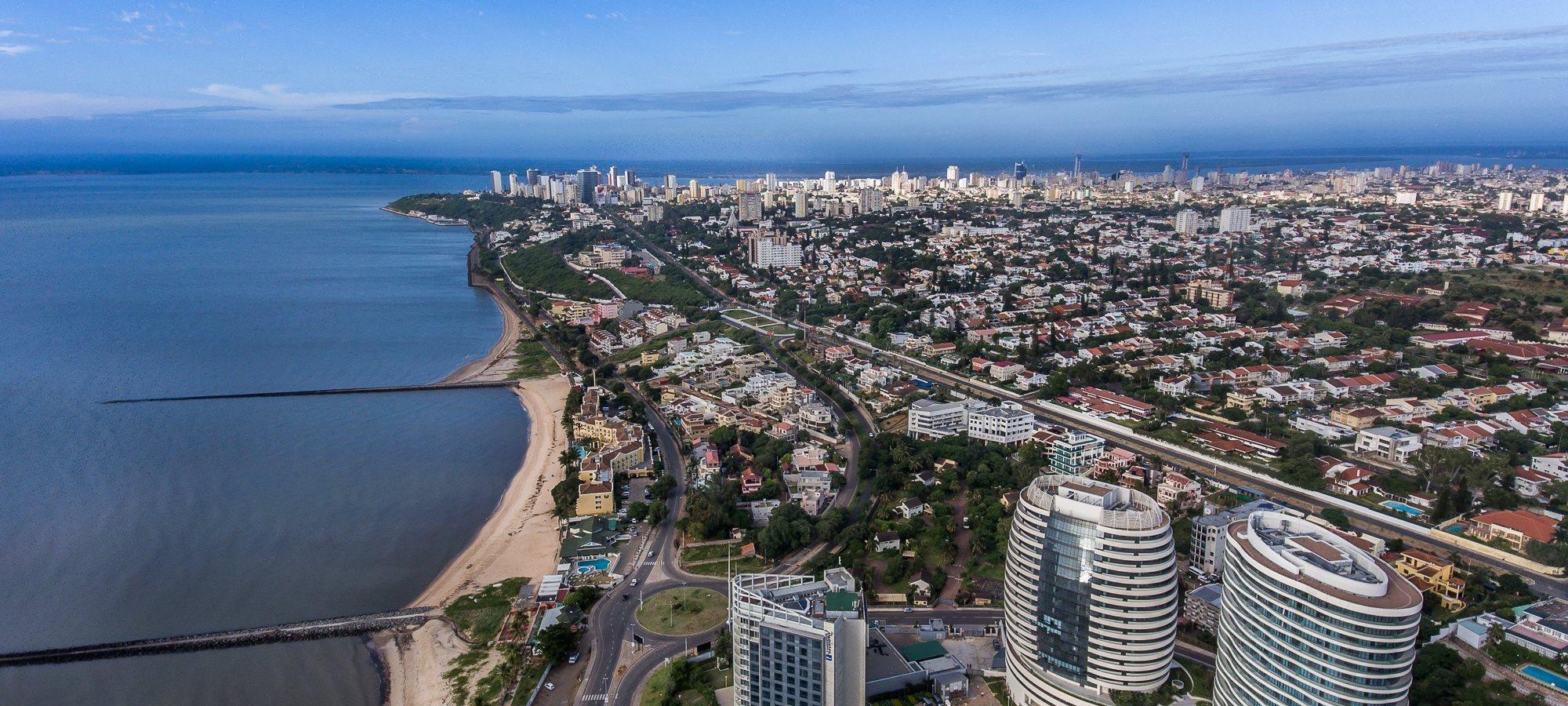
Maputo, the capital city of Mozambique, is situated in the southern part of the country. Formerly known as Lourenco Marques, it still retains some of the charm and ambiance of its Portuguese colonial past. The wide streets of Maputo are adorned with beautiful acacia and jacaranda trees, creating a picturesque setting. One of the prominent landmarks in the city is the Cathedral, located on Independence Square, which commands attention with its grandeur. Nearby, the neo-classical City Council Chambers also add to the architectural splendor of the area.

For those interested in exploring the natural history of Mozambique, the Museum of Natural History in Maputo is a must-visit. This gothic-style museum showcases a wide range of exhibits, focusing on the diverse animal species found in the country. Another historical gem in Maputo is the Fortress, one of the oldest buildings in the city, which has been transformed into a colonial history museum.

If you venture about 20 miles from Maputo, you will find the enchanting Inhaca Island in the bay. This idyllic island can be reached by both boat and aircraft, offering visitors a chance to experience its beauty and tranquility. Organized tours are available to explore different parts of the island, such as Ponta de Santa Maria or Portuguese Island.

For surf enthusiasts seeking thrilling waves, Praia da Macaneta is a destination not to be missed. This beach, known for its impressive waves, can be accessed by boat from Maputo. Whether you are interested in history, nature, or adventure, Maputo and its surrounding areas offer a diverse range of experiences for every traveler.

You might also like

Vilanculos, Mozambique

Mozambique Top Destinations

Vilanculos, Mozambique

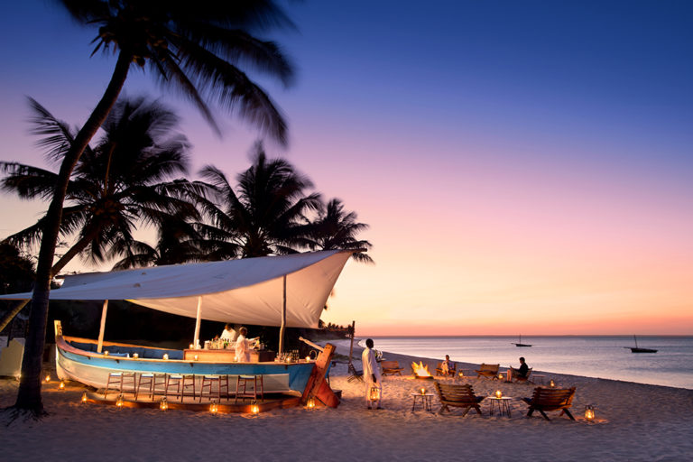
Vilanculos is a true paradise, boasting stunning beaches with powdery white sand, swaying coconut palms, and crystal-clear blue waters. Its year-round temperate climate makes it an ideal destination for a relaxing yet adventurous holiday. Whether you prefer camping, backpacking, luxurious hotels, or private self-catering homes, Vilanculos offers a wide range of accommodation options to suit every traveler’s needs.

When it comes to dining, Vilanculos does not disappoint. The town is home to a handful of excellent restaurants that serve the freshest seafood and Portuguese specialties, ensuring a delightful culinary experience. For those who prefer to cook their own meals, the local markets and fishermen provide all the necessary ingredients. Additionally, there are small supermarkets where you can find all your essential items.

Adventure awaits in Vilanculos, with a plethora of activities to choose from. Whether you’re into marlin fishing, snorkeling, boating, diving, kite surfing, or simply swimming, there is something for everyone. You can also embark on thrilling dhow sailboat trips or motorboat excursions, which offer the chance to swim with dolphins or sea turtles. The locals are known for their friendliness, and it won’t take long for you to forge lifelong friendships.

You might also like

Beira, Mozambique

Mozambique Top Destinations

Beira, Mozambique

Beira, situated at the mouth of the Pungwe River in the central region of Mozambique, serves as the country’s second major port. The city boasts the charming Largo do Munincipio square, surrounded by historic colonial buildings, terraces, tea rooms, and shops. Notable landmarks include the cathedral, constructed in 1925 using stones from the submerged 16th century Fort of Sofala, and Casa Portugal, an architectural gem in typical colonial style.

Another must-visit is the magnificent Casa Infante de Sagres. Immerse yourself in the vibrant markets, particularly the renowned Mercado do Maquino, known for its traditional potions used by local healers. Additionally, a trip to the shipwreck near the lighthouse is highly recommended.

For beach enthusiasts, the best stretches of sand can be found between the Cube Nautico and the lighthouse. Just six miles from the city center lies Six Miles, a resort featuring an artificial lagoon with islands where visitors can enjoy swimming or rent pedal boats.

You might also like

Bazaruto Archipelago

Mozambique Top Destinations

Bazaruto Archipelago

The Bazaruto Archipelago, comprised of four islands – Bazaruto, Benguerra, Margaruque, and Santa Carolina, is one of the most sought-after tourist destinations in Mozambique. Located just off the mainland, approximately 470 miles away from Maputo, these islands can be reached either by dhow from Vilanculos or through private air charter. Visitors to the archipelago can indulge in a wide range of water sports, both motorized and non-motorized, such as water skiing, parasailing, and wind surfing. Additionally, there are opportunities for deep sea fishing expeditions, as well as rock, surf, and fly fishing. 

The Mozambique Channel is renowned for its abundant marine life, including trophy-sized marlin, kingfish, sailfish, mako, wahoo, serra, yellowfin tunny, and queenfish. Snorkeling and scuba diving enthusiasts are drawn to the archipelago’s coral reefs and crystal-clear waters, with options for night and wreck dives available. The archipelago’s rugged terrain, coupled with its natural beauty, makes it an ideal destination for hikers. Bird watchers will be delighted by the 164 different species identified in the Bazaruto Archipelago, with Benguerra Island alone being home to 115 types, including rare species like the crab plover, olive bee eater, green coucal, and narina troga. 

Mozambique’s diverse habitats contribute to its impressive array of bird life, with over 900 species recorded. Marine life in the area includes the majestic dugong and various species of dolphins, while humpback whales can be spotted during the summer months. On land, visitors may encounter small suni and duiker antelope, which have recently been reintroduced to the island.

You might also like

Kigali

Rwanda Top Destinations

Kigali

Rwanda, being located in East Africa, has extensive natural beauty. Expeditions visit volcanoes, waterfalls, and rainforests that are home to many different African animals. Rwanda is home to a huge, diverse population of animals, including mountain gorillas, and the world’s largest natural park for hippos, of which 20,000 are believed to live there.

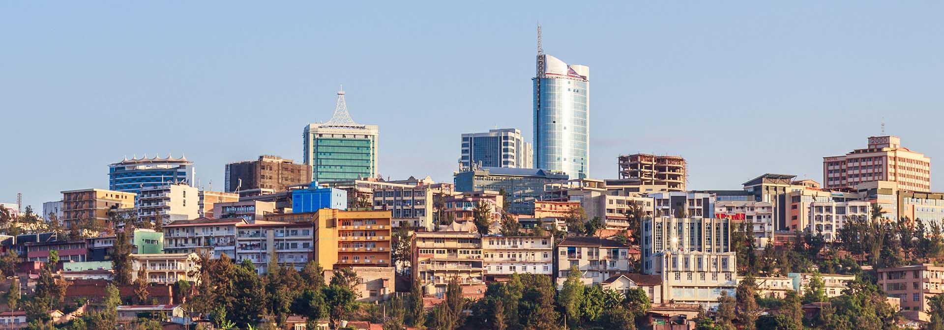
Kigali, situated over several hills and valleys, Kigali is the capital city of Rwanda and is home to the main administrative and commercial centres of the nation as well as over one million people.

You might also like

Nyungwe Forest National Park

Rwanda Top Destinations

Nyungwe Forest National Park

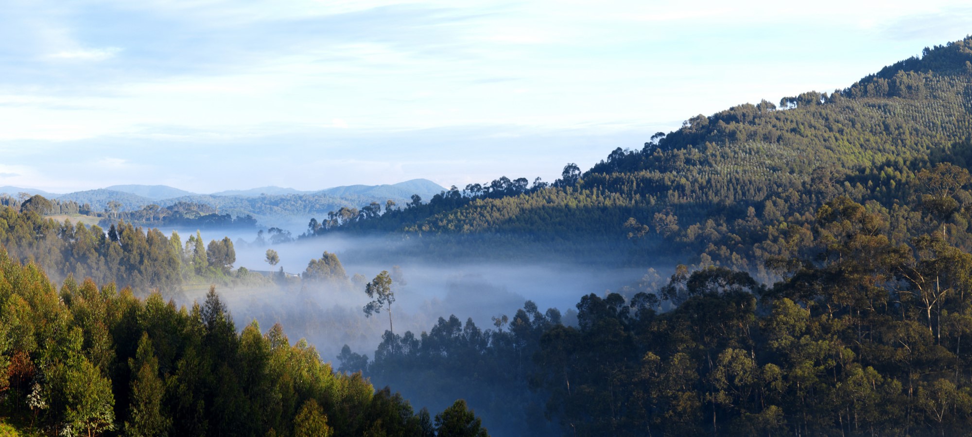
The Nyungwe rainforest is situated in the southwestern part of Rwanda, sharing its borders with Burundi and the Democratic Republic of the Congo. It is widely regarded as the most well-preserved rainforest in the mountainous regions of Central Africa. Positioned between the Congo River basin to the west and the Nile River basin to the east, this forest plays a crucial role in the watershed. Notably, it is home to a remarkable 25% of Africa’s primate species, including a significant population of chimpanzees, making chimpanzee trekking a major highlight of the national park.

Established in 2004, Nyungwe Forest National Park spans an area of nearly 1000 sq km, encompassing rainforest, bamboo forests, grasslands, swamps, and bogs. Apart from its rich biodiversity, Nyungwe also serves as a vital water source for Rwanda and harbors numerous natural resources that are essential for the well-being of the country’s human population.

By Road:

Nyungwe forest national park can be found in the southwestern part of Rwanda, in close proximity to Lake Kivu and the Democratic Republic of Congo. It is situated near the town of Cyangugu, approximately 225km away from Kigali, which can be reached by a 4-5 hour drive. The journey commences in Kigali, heading south, passing through various towns. One of the notable cities along the way is Huye town, located about 32km from Kigali. The road leading up to Huye town is relatively smooth, although it does have some sharp turns that require cautious driving. After covering a distance of around 200km, you will arrive at Nyungwe forest national park.

By Air:

If you are in need of a faster mode of transportation, consider booking a flight with RwandAir. This airline provides domestic flights, including the Kigali-Kamembe route. RwandAir operates a minimum of 9 flights per week from Kigali to Kamembe International Airport. Kamembe airport is conveniently located just 32km away from Nyungwe Forest Lodge, where helicopter pickups are available. This arrangement can be quite convenient if it fits within your budget. Planning a trip to Nyungwe Forest National Park should not be a challenge if you plan it well. One way to simplify the process is by hiring a safari company to handle the arrangements on your behalf.

There are several popular activities to engage in while visiting Nyungwe Forest National Park. These include gorilla trekking, exploring the diverse primate species of Nyungwe, experiencing the thrilling Nyungwe Canopy Walks, and embarking on walking bird safaris.

Nyungwe Forest, situated at an elevation ranging from 2000 to 3000 meters, is a montane rainforest. Despite its tropical location near the equator, the forest’s altitude ensures a consistently pleasant temperature throughout the year. With an annual rainfall exceeding 2000 mm, the forest thrives in abundant precipitation. The temperature remains relatively stable at around 25°C, rarely dropping below 15°C during nighttime. This unique combination of ample rainfall, ample sunlight, and favorable temperatures contributes to Nyungwe Forest’s status as one of Africa’s most diverse habitats. It is home to approximately 300 bird species, with 26 being endemic, as well as around 100 other animal species. Additionally, the forest boasts thousands of plant species, including several endemic orchids.

You might also like

Volcanoes National Park

Rwanda Top Destinations

Volcanoes National Park

Located in the far northwest of Rwanda, the Parc des Volcans safeguards the steep slopes of this magnificent mountain range, which is the habitat of the rare mountain gorilla, as well as a diverse range of montane ecosystems, including evergreen and bamboo forests, open grasslands, swamps, and heaths.

Embarking on an exhilarating trek through the cultivated foothills of the Virungas provides breathtaking panoramic views in every direction. Suddenly, the trail leads into the national park, immersing trekkers in the enchanting intimacy of the rainforest, teeming with the vibrant calls of birds and the chatter of the elusive golden monkey. The forest floor is scattered with fresh tracks of the mountains’ elusive buffalo and elephant populations. Through breaks in the forest canopy, glimpses of the majestic peaks can be seen, easily accessible and among the highest in Africa, beckoning adventurers to ascend.

The bustling market town of Ruhengeri is nestled at the base of the Virungas, offering a memorable setting. Just outside the town, the natural bridge at Musanze, formed by solidified lava, stands as a captivating relic of the volcanic activity that shaped this picturesque area. Lakes Burera, Ruhondo, and Karago, which are rarely visited but incredibly beautiful, are also within easy reach of Ruhengeri. The town provides a range of reasonably priced small hotels and guest houses, including the recently renovated Gorilla’s Nest hotel. Alternatively, visitors can choose to stay in Gisenyi or Kigali and make a day trip to the Parc des Volcans and Ruhengeri with an early start.

By Road:

Volcanoes National Park is situated in the quaint village of Musanze, formerly known as Ruhengeri. This village is easily accessible by public transportation from Gisenyi, Kigali, or the airport. The journey to the national park takes approximately 2 hours, allowing visitors to engage in gorilla tracking on the same day and return to Kigali afterwards. To ensure a successful gorilla trekking experience, it is essential to arrive at the ORTPN headquarters in Kinigi, located at the park entrance, by 7:00 am. Therefore, if you plan to embark on a one-day gorilla trek, you must wake up early to commence your journey and ensure punctuality. It is important to note that there is no public transportation available from Musanze to the park headquarters in Kinigi.

The Volcanoes National Park offers a variety of activities for visitors to enjoy. These include gorilla trekking, hiking the Karisimbi volcano which stands at an impressive 3,800 meters, embarking on a one-day hike up Mount Bisoke volcano, exploring the Dian Fossey Memoratorium, and taking in the breathtaking views of the twin lakes of Ruhondo and Bulera.

The Volcanoes National Park offers favorable weather conditions for outdoor activities all year round. However, there are certain weather patterns that visitors should be aware of. The area experiences extended periods of rainfall, heavy downpours, frequent mist, and cool temperatures.

At the national park’s Headquarters, which is located at an altitude of approximately 2400 meters, the average day temperatures range from 11 to 19 degrees Celsius. As one climbs higher on the slopes of the volcanoes, the air becomes colder. It is not uncommon to experience freezing temperatures in the early morning at around 3000 meters and higher altitudes. In fact, the summit of Mt. Karisimbi is often covered in a cap of snow.

The climate in the area can be divided into four seasons. The long dry season typically lasts from mid-June to mid-September. This is followed by short rains from October to December, and then a short dry season in January and February. The long rains begin in March and continue until the end of May. However, it is important to note that rain can occur at any time throughout the year in the Virunga region. The volcanoes themselves are often enveloped in mist.

Rainfall is not evenly distributed across the Virunga range. The western volcanoes, such as Mt. Karisimbi and Mt. Visoke, receive more rainfall compared to the eastern ones, including Mt. Sabyinyo, Mt. M’Gahinga, and Mt. Muhabura.

The highest amount of precipitation occurs at elevations around 2500 to 2700 meters, which is close to the lower boundary of the Volcanoes National Park. As one goes higher, the rainfall decreases significantly, and the highest slopes of the volcanoes are relatively drier. However, they are often obscured by thick cloud formations. The annual rainfall at the summit of Mt. Karisimbi is approximately 940 mm, which is about half the amount of rainfall at 2500 meters.

The Virunga forest plays a crucial role in regulating the climate and acting as a water reservoir. It acts like a sponge, providing a regular water supply for hundreds of thousands of people in Northwest Rwanda.

You might also like